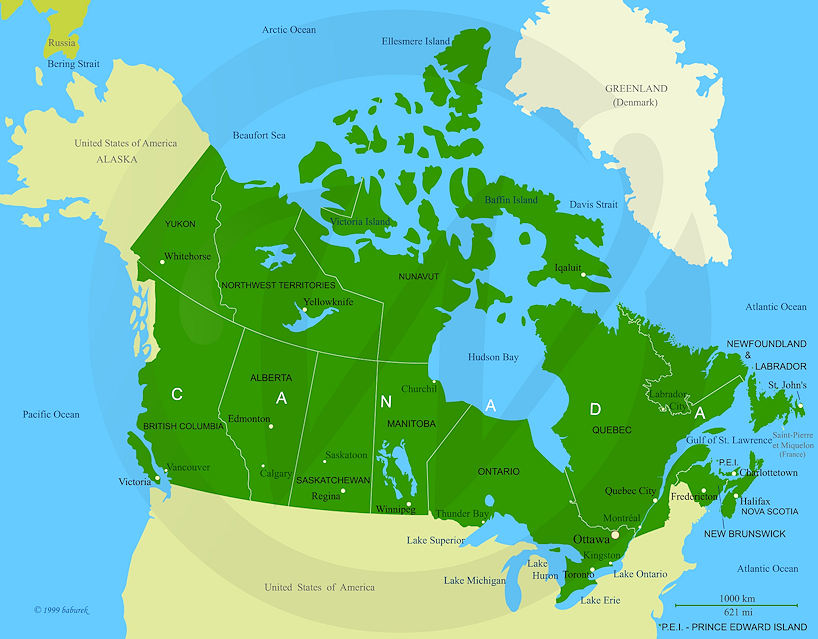
Map of Canada
Canada is a country located in North America. Canada is bordering on the South with the United States of America (map) in its full length – 8,891 km or 5524 mi. Elsewhere Canada is surrounded with three Oceans; Atlantic Ocean on the East, Pacific Ocean on the West and the Arctic Ocean on the North.
Canada on the Map

Canadian provinces on the maps; Alberta, British Columbia, Manitoba, New Brunswick, Newfoundland and Labrador, Nova Scotia, Ontario, Québec, Prince Edward Island, and the Saskatchewan.
Canadian territories on the maps; Northwest Territories, Nunavut, and the Yukon.